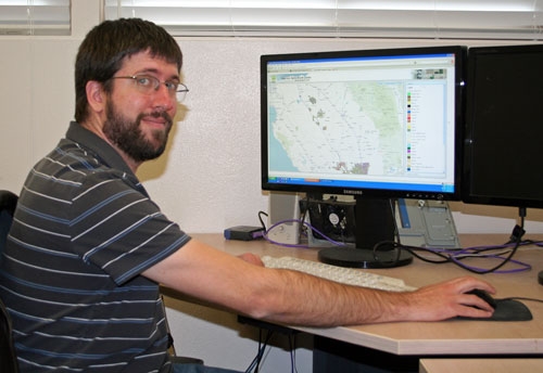
The Geographic Information Systems (GIS) team at the Kearney Agricultural Research and Extension Center is growing this year. The program will add two positions in the coming months with new grant funding as more scientists recognize the value of employing spatial mapping in their agricultural research, said Kris Lynn-Patterson, the GIS Academic Coordinator at Kearney.

In one of the new projects, the Kearney GIS team will work with Beth Grafton-Cardwell, a UC Riverside citrus entomology specialist and director of the UC Lindcove Research and Extension Center, to provide the spatial information necessary to better manage Asian citrus psyllid (ACP) and the possible future occurrence of Huanglongbing, a devastating citrus disease that the psyllid can spread. ACP was introduced into California in 2008; large populations are now established in urban areas of San Diego, Imperial, Los Angeles, San Bernardino and Riverside counties. Huanglongbing has not been detected in California to date. The California Department of Food and Agriculture and citrus growers are treating urban and agricultural areas of infestation to prevent ACP spread and Huanglongbing introduction.
GIS will be used to document the locations of ACP infestations and the disease, and analyze the risk and rate of spread from the urban areas into commercial citrus. The research is funded by a five-year grant from UC Agriculture and Natural Resources to conduct risk assessment, economic analysis and extension education for Asian citrus psyllid and Huanglongbing disease management in California.
Kearney GIS also secured a contract with the Citrus Research Board to map all commercial citrus orchard locations and boundaries in California.
“This will go hand in hand with the Asian citrus psyllid research,” Lynn-Patterson said. “Currently a seamless GIS map layer of this type doesn’t exist, but is badly needed to facilitate the effective use of GIS in an area-wide pest management program.”
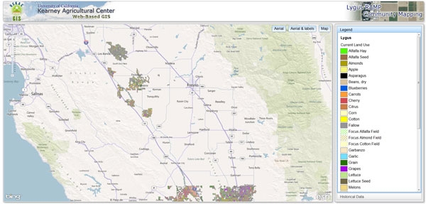
Another source of funding for the GIS program has been Cotton Incorporated and the California Cotton Alliance for continuing work with Kearney-based UC integrated pest management advisor Pete Goodell. GIS is critical to understanding the movement of lygus bugs through the San Joaquin Valley’s diverse cropping landscapes and the relationship between crops that act as sources (places from which lygus originate) or sinks (crops into which lygus move). Throughout the year, lygus feed on various crops and weeds, and when these become unsuitable, they move into cotton, where lygus costs farmers nearly $19 million in yield loss each year.
The GIS team will build on the existing Lygus Community Mapping Program by incorporating lygus monitoring data, and delivering the program through smart mobile devices, such as 3G- and 4G-compatible cell phones and tablets.
See Kearney’s Web-based GIS website for more information on the program.
Attached Images:

A land use map that is part of the lygus project.